Monthly Archives

July 2017

Consultation on the SafeUse of Drones in the UK Government Response Department of Transport

By | UK Drone Legalities | No Comments

The drones are coming – but their use will now be regulated, as the government announced this morning that devices must now be registered and users will have to sit safety awareness tests.

After running a consultation from December to March, the government today published a response outlining plans to make owners of drones weighing 250g and more register details of their device.

Unlocking the UK’s High Tech Economy: Consultation on the SafeUse of Drones in the UK Government Response Department of Transport

“The UK is at the forefront of an exciting and fast growing drones market and it is important we make the most of this emerging global sector,” said aviation minister Lord Callanan.

Increasingly, drones are proving vital for inspecting transport infrastructure for repair or aiding police and fire services in search and rescue operations, even helping to save lives. They are also used extensively for aerial photography, filming and surveys.

But like all technology, drones too can be misused. By registering drones and introducing safety awareness tests to educate users, we can reduce the inadvertent breaching of airspace restrictions to protect the public.

The government also said it plans to bring forward and expand the use of “geo-fencing”, a technology which acts as an invisible force field around buildings or sensitive areas such as prisons, nuclear plants or airports.

This works by programming drones to hover at the edge of certain zones. Some manufacturers already have this feature locked in, but the government aims to reinforce its practice.

The consultation summary also added that “options to increase penalties when the law is broken” were being explored.

In the consultation, bodies such as the Department for Transport, the British Airline Pilots Association and the Military Aviation Authority revealed evidence that drones weighing 400g could damage the windscreens of helicopters in particular. A particular concern for drones being operated in the English Lake District in Cumbria, where the RAF regularly fly in LFA17 (military designated fly zone).

Airliner windscreens were found to be much more resistant, as it would take a drone of around 2kg to cause critical damage and only if the aeroplane was flying at high speed.

https://www.gov.uk/government/uploads/system/uploads/attachment_data/file/631638/unlocking-the-uks-high-tech-economy-consultation-on-the-safe-use-of-drones-in-the-uk-government-response.pdf

The outcome of the consultation is welcomed by Hovershotz Aerial Drone Photography Video & Inspections Cumbria, as we already follow strict processes laid down by the CAA (Civil Aviation Authority) to comply with our permission for commercial Operation (PFCO) and we have become frustrated with the antics of cowboy drone operators.

Last year, the Civil Aviation Authority launched a new “drone code” with six principles:
Always keep your drone in sight
Stay below 400ft (120m) to comply with the drone code
Every time you fly your drone you must follow the manufacturer’s instructions
Keep the right distance from people and property
You are responsible for each flight
Stay well away from aircraft, airports and airfields


UK Government to announce new drone registration and regulations.

By | UK Drone Legalities | No Comments

Hovershotz have learned that the UK government are to announce plans to introduce drone registration and mandatory safety awareness courses for owners of the small unmanned aircraft (SUSA’s).

It will affect anyone who owns a drone which weighs more than 250 grams (8oz).

Drone maker DJI said it was in favour of the measures.

There is no time frame or firm plans as to how the new rules will be enforced and the Department of Transport admitted that “the nuts and bolts still have to be ironed out”.

The drone safety awareness test will involve potential flyers having to “prove that they understand UK safety, security and privacy regulations”, it said.

The plans also include the extension of geo-fencing, in which no-fly zones are programmed into drones using GPS co-ordinates, around areas such as prisons, nuclear power plants and airports.

‘Protect the public’

“Our measures prioritise protecting the public while maximising the full potential of drones,” said Aviation Minister Lord Martin Callanan.

“Increasingly, drones are proving vital for inspecting transport infrastructure for repair or aiding police and fire services in search and rescue operations, even helping to save lives.

“But like all technology, drones too can be misused. By registering drones and introducing safety awareness tests to educate users, we can reduce the inadvertent breaching of airspace restrictions to protect the public.

There has not been a significant accident involving a drone yet, but there have been several reports of near misses with commercial aircraft. There have also been incidents of drones being used to deliver drugs to prison inmates.

“Registration has its place. I would argue it will focus the mind of the flyer – but I don’t think you can say it’s going to be a magic solution,” said Dr Alan McKenna, law lecturer at the University of Kent.

“There will be people who will simply not be on the system, that’s inevitable.”

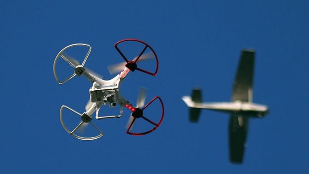
Drone and aircraft

Similar registration rules in the US were successfully challenged in court in March 2017 and as a result are currently not applicable to non-commercial flyers.

Dr McKenna said there were also issues around how a drone’s owner could be identified by police and whether personal liability insurance should also be a legal requirement in the event of an accident.

‘Common sense’

DJI spokesman Adam Lisberg said the plans sounded like “reasonable common sense”.

“The fact is that there are multiple users of the airspace and the public should have access to the air – we firmly believe that – but you need systems to make sure everybody can do it safely,” he said.

“In all of these issues the question is, where is the reasonable middle ground? Banning drones is unreasonable, having no rules is also unreasonable.

“We’re encouraged that [the British government] seems to be recognising the value drones provide and looking for reasonable solutions.”

Currently only commercial drone operators are regulated by the Civil Aviation Authority (CAA) and have to pass strict theory exams, flight tests and hold specific insurance.

Hovershotz aerial drone photography video and inspections Cumbria, welcome these new rules. We regularly come across idiots who have bought a cheap drone and then fly it dangerously without any knowledge of the current rules or what constitutes safe flights. This is of particular concern in Cumbria and the Lake District; where tourists regularly fly drones to film & video the dramatic scenery, without considering that it is a military fly zone.

Drone filming service for any of the Wainwright fells in the Lake District

By | Uncategorised | No Comments

There are 214 Wainwright Fells in the Lake District

Below is a list of the 214 Wainwright fells in the Lake District. Hovershotz are able to hike over any of the Wainwrights with our drones in backpacks to provide aerial filming or drone photography from any of these.

No. HILL AREA ALT.(m)
1 Scafell Pike S 978
2 Scafell S 964
3 Helvellyn E 950
4 Skiddaw N 931
5 Great End S 910
6 Bowfell S 902
7 Great Gable W 899
8 Pillar W 892
9 Nethermost Pike E 890
10 Catstycam E 889
11 Esk Pike S 885
12 Raise (Helvellyn) E 883
13 Fairfield E 873
14 Blencathra N 868
15 Skiddaw Little Man N 865
16 White Side E 863
17 Crinkle Crags S 858
18 Dollywaggon Pike E 858
19 Great Dodd E 857
20 Grasmoor NW 851
21 Stybarrow Dodd E 844
22 Scoat Fell W 841
23 St. Sunday Crag E 840
24 Eel Crag NW 838
25 High Street FE 828
26 Red Pike (Wasdale) W 825
27 Hart Crag E 822
28 Steeple W 819
29 Lingmell S 807
30 High Stile W 806
31 Coniston Old Man S 803
32 High Raise (H.St.) FE 803
33 Kirk Fell W 802
34 Swirl How S 802
35 Green Gable W 801
36 Haycock W 798
37 Brim Fell S 796
38 Dove Crag E 792
39 Rampsgill Head FE 792
40 Grisedale Pike NW 790
41 Watson’s Dodd E 789
42 Great Carrs S 785
43 Allen Crags S 784
44 Glaramara S 783
45 Thornthwaite Crag FE 783
46 Kidsty Pike FE 780
47 Dow Crag S 779
48 Harter Fell (Mardale) FE 778
49 Red Screes E 776
50 Grey Friar S 773
51 Sail NW 773
52 Wandope NW 772
53 Hopegill Head NW 770
54 Great Rigg E 766
55 Caudale Moor FE 763
56 Wetherlam S 763
57 High Raise (Lang.) C 762
58 Slight Side S 762
59 Mardale Ill Bell FE 761
60 Ill Bell FE 757
61 Hart Side E 756
62 Red Pike (Butterm.) W 756
63 Dale Head NW 754
64 Carl Side N 746
65 High Crag W 745
66 The Knott FE 739
67 Robinson NW 737
68 Harrison Stickle C 736
69 Seat Sandal E 736
70 Sergeant Man C 736
71 Long Side N 733
72 Kentmere Pike FE 731
73 Hindscarth NW 727
74 Clough Head E 726
75 Ullscarf C 726
76 Froswick FE 719
77 Birkhouse Moor E 718
78 Thunacar Knott C 717
79 Brandreth W 714
80 Lonscale Fell N 714
81 Branstree FE 713
82 Knott N 710
83 Pike o’Stickle C 708
84 Whiteside NW 706
85 Yoke FE 706
86 Pike o’Blisco S 705
87 Bowscale Fell N 703
88 Cold Pike S 701
89 Caw Fell W 697
90 Gray Crag FE 697
91 Pavey Ark C 697
92 Rest Dodd FE 696
93 Grey Knotts W 694
94 Loft Crag C 692
95 Seatallan W 691
96 Great Calva N 690
97 Bannerdale Crags N 683
98 Ullock Pike N 680
99 Sheffield Pike E 675
100 Wether Hill FE 674
101 Bakestall N 673
102 Scar Crags NW 672
103 Loadpot Hill FE 671
104 Tarn Crag (Longsled.) FE 663
105 Carrock Fell N 661
106 Whiteless Pike NW 660
107 High Pike (Caldbeck) N 657
108 High Pike (Scandale) E 657
109 Place Fell FE 657
110 Selside Pike FE 655
111 Middle Dodd E 654
112 High Spy NW 653
113 Harter Fell (Eskdale) S 652
114 Great Sca Fell N 651
115 Fleetwith Pike W 648
116 Base Brown W 646
117 Rossett Pike S 642
118 Grey Crag FE 638
119 Causey Pike NW 637
120 Little Hart Crag E 637
121 Mungrisdale Common N 633
122 Starling Dodd W 633
123 Yewbarrow W 627
124 Birks E 622
125 Hartsop Dodd FE 618
126 Great Borne W 615
127 Heron Pike E 612
128 High Seat C 608
129 Illgill Head S 604
130 Seathwaite Fell S 600
131 Haystacks W 597
132 Bleaberry Fell C 589
133 Shipman Knotts FE 587
134 Brae Fell N 585
135 Middle Fell W 582
136 Ard Crags NW 581
137 Maiden Moor NW 575
138 The Nab FE 575
139 Blake Fell W 572
140 Sergeant’s Crag C 571
141 Hartsop Above How E 570
142 Outerside NW 568
143 Angletarn Pikes FE 566
144 Brock Crags FE 561
145 Knott Rigg NW 556
146 Lord’s Seat NW 552
147 Steel Fell C 552
148 Rosthwaite Fell (Bessyboot) S 551
149 Hard Knott S 550
150 Meal Fell N 550
151 Tarn Crag (Easedale) C 549
152 Blea Rigg C 541
153 Lank Rigg W 541
154 Calf Crag C 537
155 Great Mell Fell E 536
156 Whin Rigg S 535
157 Arthur’s Pike FE 532
158 Gavel Fell W 526
159 Great Cockup N 526
160 Bonscale Pike FE 524
161 Crag Fell W 523
162 Souther Fell N 522
163 High Hartsop Dodd E 519
164 Whinlatter NW 517
165 High Tove C 515
166 Sallows FE 515
167 Mellbreak W 511
168 Beda Fell FE 509
169 Broom Fell NW 509
170 Hen Comb W 509
171 Low Pike E 508
172 Little Mell Fell E 505
173 Stone Arthur E 504
174 Eagle Crag C 503
175 Dodd N 502
176 Green Crag S 488
177 Grike W 488
178 Wansfell FE 487
179 Longlands Fell N 483
180 Sour Howes FE 483
181 Gowbarrow Fell E 481
182 Armboth Fell C 479
183 Burnbank Fell W 475
184 Lingmoor Fell S 469
185 Barf NW 468
186 Raven Crag C 461
187 Great Crag C 457
188 Barrow NW 455
189 Catbells NW 451
190 Graystones NW 450
191 Binsey N 447
192 Glenridding Dodd E 442
193 Nab Scar E 442
194 Arnison Crag E 434
195 Steel Knotts FE 431
196 Buckbarrow W 430
197 Gibson Knott C 420
198 Fellbarrow W 415
199 Grange Fell C 415
200 Low Fell W 412
201 Helm Crag C 405
202 Silver How C 394
203 Hallin Fell FE 387
204 Walla Crag C 379
205 Ling Fell NW 373
206 Latrigg N 367
207 Troutbeck Tongue FE 363
208 Sale Fell NW 359
209 High Rigg C 357
210 Rannerdale Knotts NW 355
211 Loughrigg Fell C 336
212 Black Fell S 322
213 Holme Fell S 317
214 Castle Crag NW 290

Hovershotz offer:@

aerial drone filming in the Lake District & Cumbria

aerial drone photography in the Lake District & Cumbria

Contact us now if you require drone operator service, photography or filming on any of the Cumbrian Lake District Mountains

https://www.hovershotz.co.uk/contact/

email andy@hovershotz.co.uk or phone Andy on 07962 444482

Call us